 Waves and Sea Levels on the Fly: GeoNet Sites
Introduction
On this webpage we provide a means to view the long waves and sea levels that have occurred at a tsunami gauge over a set of days that you specify.
Long waves are split into two categories:
- Infra Gravity Waves: waves with periods between 25 and 120 s. These waves affect ships at berth, causing the vessel to surge.
- Far Infra Gravity Waves: waves with periods from 2 to 60 min. These waves can cause inundation.
Other waves in this category are:- Tsunami: generated by earthquakes, submarine avalanches, or caldera;
- Meteo-Tsunami: generated by rapidly moving low-pressure systems.
Sea levels have the following components:
- Far Infra Gravity Waves: 2 to 60 min periods;
- Tide: 3 to 24 h periods; and
- Storm surge: 24 h and longer periods.
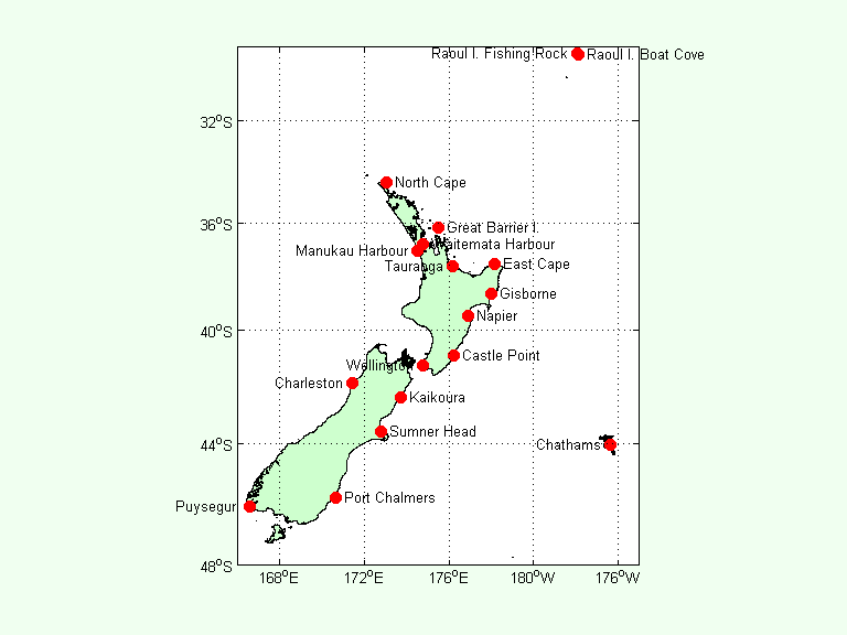
The data are retrieved from one of the
GeoNet sites
at intervals of 1 s (1 Hz data).
IG waves are calculated from the raw 1 Hz data.
Sea levels are calculated by taking 1-min means of 1 Hz data.
This simulates a traditional tide gauge.
We acknowledge the New Zealand GeoNet project and its sponsors Earthquake Commission (EQC), GNS Science, and Land Information New Zealand (LINZ).